How Nature May Reveal Secrets in Geolocation
As an analyst, using points of reference in the surroundings of a photo is not a new concept. Verifying a photo or video often comes down to tracking down city skylines, mountain/land horizons, and street names. However, I began to wonder how difficult it would be to use natural clues to tighten the scope of a location on both a national and global scale.
I have seen survivalists on TV navigate through the deep woods using only their knowledge of plants and sun charting. If they can do it, I thought maybe similar skills could be used to verify images. After doing some research, I determined there are several techniques that can be harnessed to gain clues from imagery that may point us to specific locales based on plants and animals.
Note: I am not a survivalist or even the slightest bit a nature expert. I have camped maybe 3 times in my whole life and would probably die after one day in nature, so please be sure to verify any findings based on these techniques.
Identify Native Plants
Imagine that we have received a photograph for analysis of a densely wooded area where a crime has taken place. We have nothing concrete to go on in the photo but the surrounding nature. Where should we begin?
Identifying plants in your photo that may be native to the area is a great starting point. Native plants, if specific enough, may allow us to determine the state or country where the photo was taken.
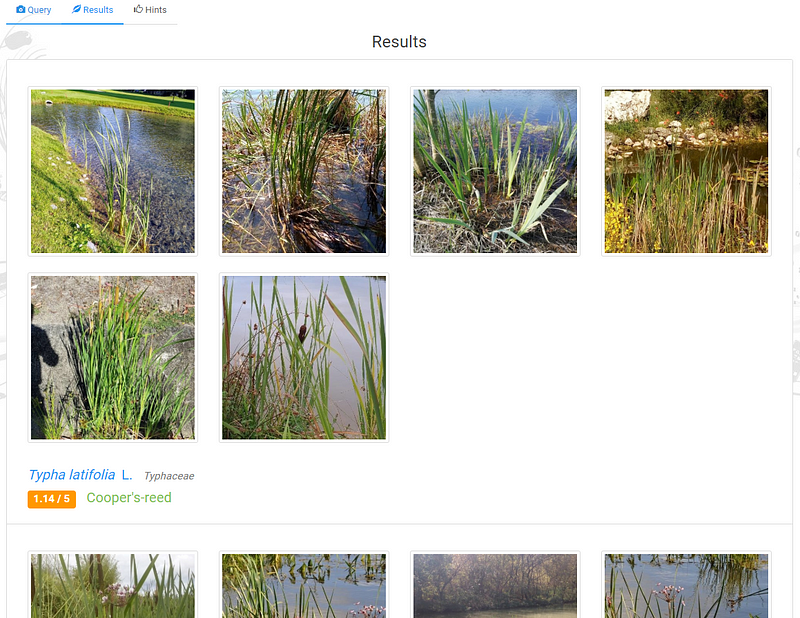
As an example, I grabbed a picture from Sector035's Quiztime in March, cropping it down to just the plants in the water. Next, I went to identify.plantnet.org to try to identify the grass.
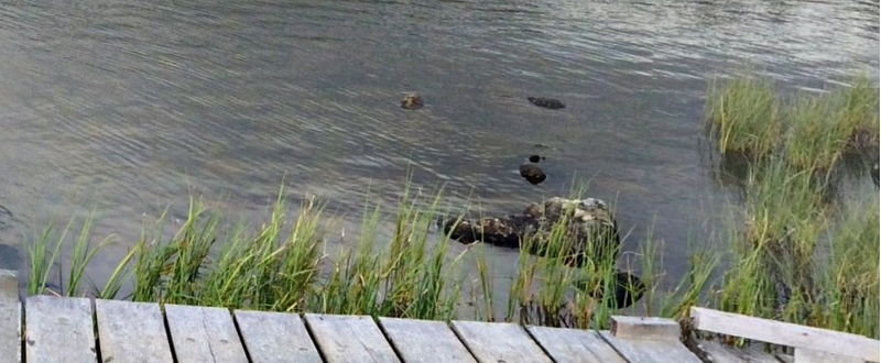
Identify.plantnet.org offers a plethora of potential suggestions for what this grass might be. It also provides several photos for each so we can compare them to our original. At first glance, I think it looks pretty close to the first option of Cooper’s Reed.
Being able to identify a native plant is just the first step. Many native plants exist in other places beyond its native habitat so while this may help narrow the scope, I wouldn’t consider it definitive. If the photo in question looks like a man-made landscape (i.e. gardeners planted the plants) this trick wouldn’t be very useful.
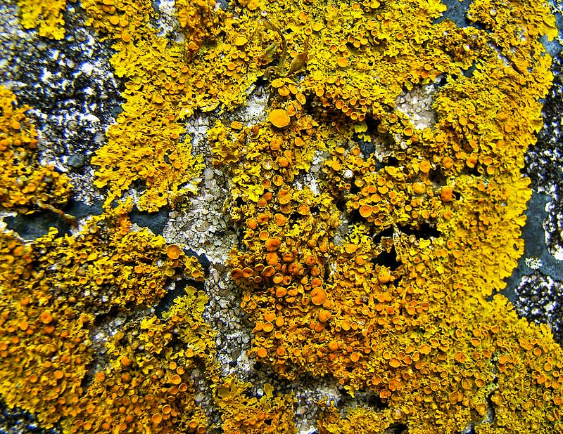
The habits of plant growth are also worth considering here. For instance, the majority of Lichen types are grey or green and are known to grow in shady areas, however, the rust-colored (Xanthoria Perientina) type grows only on south-facing surfaces. If you note something this specific in your photo it could be an indication of physical direction.
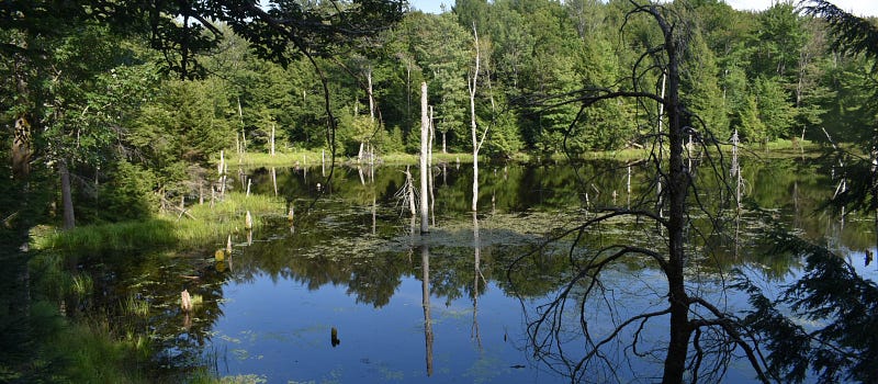
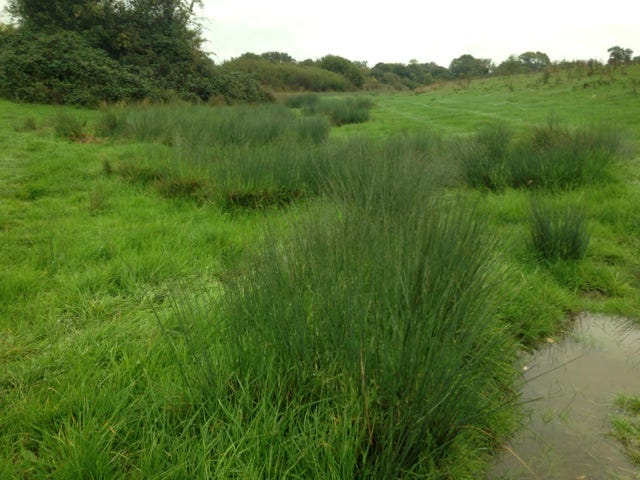
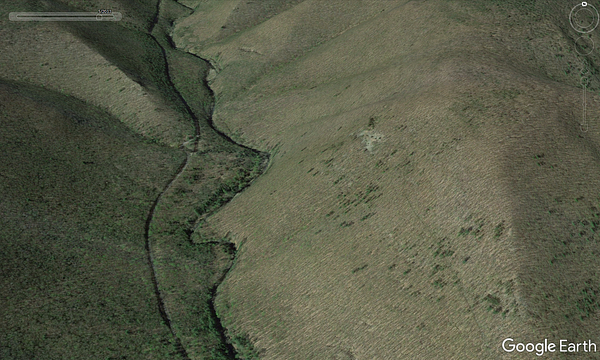
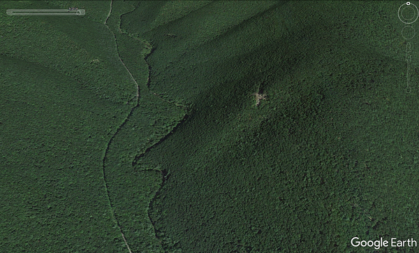
Additionally, grasses such as Soft Rush tend to indicate wet areas in the ground and a potential swamp nearby. We can see the patches of grass in the photo below where the ground is wetter than the surrounding area. These types of patterns are also found in tree growth as we will cover in the next section.
Analyzing Trees and Global Treelines
Naturalists train themselves to notice how the sun influences plant growth and how wind direction can shape a tree line. We can also attempt to determine the surrounding terrain in our photo by looking at the types of trees.
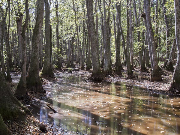
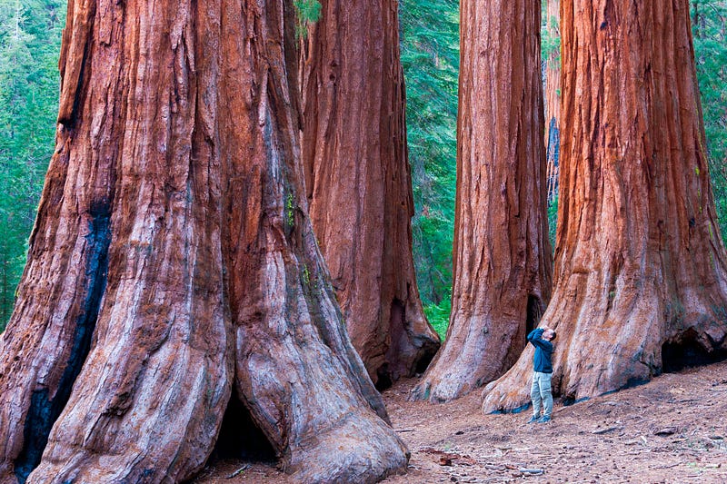
Certain tree species can also be noted across particular geographical areas in the U.S. For instance, the (Tupelo) trees below are seen most often in the southern region and up the east coast, where they thrive in swampy, standing water. While giant redwood trees can be found on the west coast in California. Furthermore, we may be able to ascertain changes in the environment through tree spotting. Lines of Willows and Alders like to grow near rivers and are often an indication of a nearby water source.
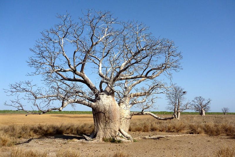
Determining the country of origin is also a possibility when examining tree species. Something like a Boab tree may narrow our search down to specific areas in Australia, Madagascar, and Africa. In North America, we can use the site What Tree is That? to help identify distinct tree species.
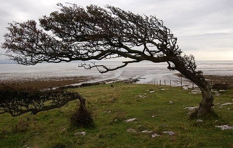
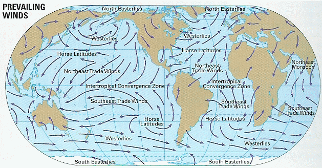
One interesting thing I came across in my research is the use of tree wind damage as an indicator of facing direction. Lone deciduous trees like this one below are the best source for this type of analysis. Because the wind blows consistently in certain directions based on prevailing winds and can eventually push a tree’s branches to grow in the same way. If we know the general region that our photo was taken, we could compare it with wind maps to help pinpoint potential locales.
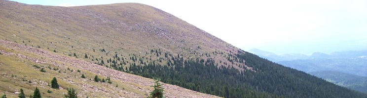
Finally, tree placement along the landscape might demonstrate the altitude of our photo. Looking at this photo below, we can clearly see the strange tree phenomenon that no one can fully explain called the “global treeline.” The global treeline is a rough line of trees revealing an area of elevation where they are no longer able to flourish, whether due to soil issues or decreased air. The global treeline could be used in verification to roughly determine the elevation in the photo.
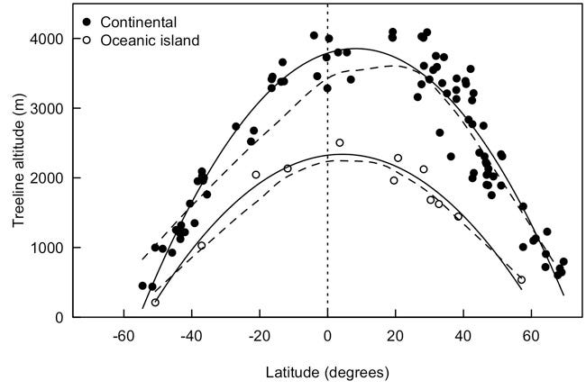
The tricky part about using timberlines for geolocation is that while it is a global phenomenon, the altitude varies by area as shown in this chart below. I think to be useful for verification we would need to have a general idea of a starting location.
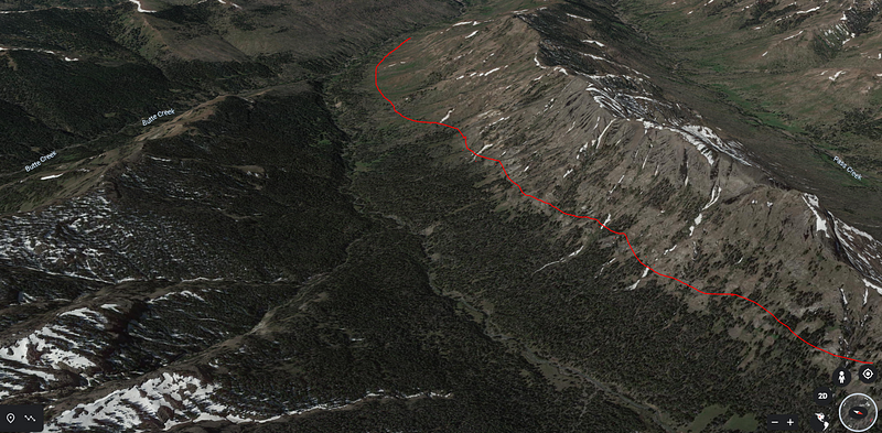
There have also been interesting studies on identifying trees at large scale in aerial photographs, which appears to mostly be done through the use of algorithms. There are a few techniques I pulled from Deer Hunting sites that we may be able to use here using Google Earth . It appears that hunters are using Google Earth to look up their hunting grounds ahead of time and using trees to find potential deer paths. The hunters are able to determine whether a set of trees are a certain species by using the Google Earth history option and looking at the area in fall or winter. Oak trees hold their leaves longer into the fall/winter season so they would show on the sat photos. In the fall we can also use color to determine what type of tree it might be.
Identifying Farm Crops from Aerial/Sat Photos
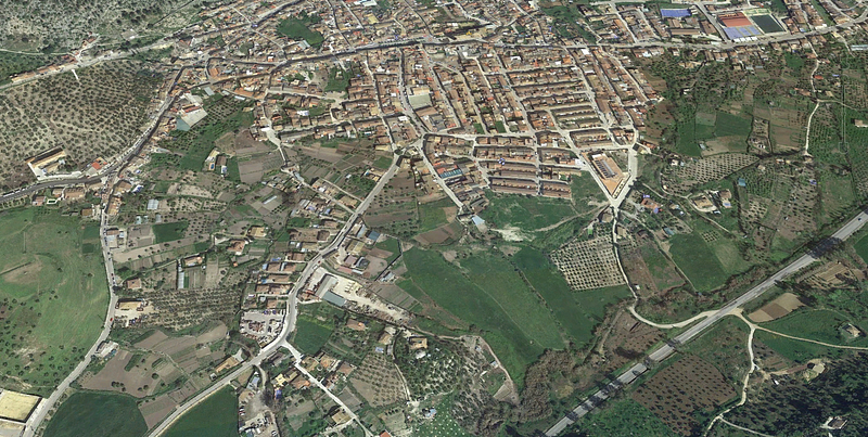
It may be possible to narrow the scope of location in an aerial or sat photo by determining the farm crops in the area. Often certain crops are only grown in specific regions and can be determined using the layout of the fields and plants and animals present.
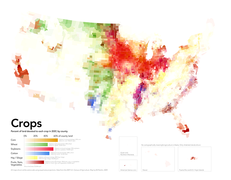
Below we can see when placed side-by-side that corn, soybeans, rice, and olives are all grown in specific ways that often stand out in imagery.
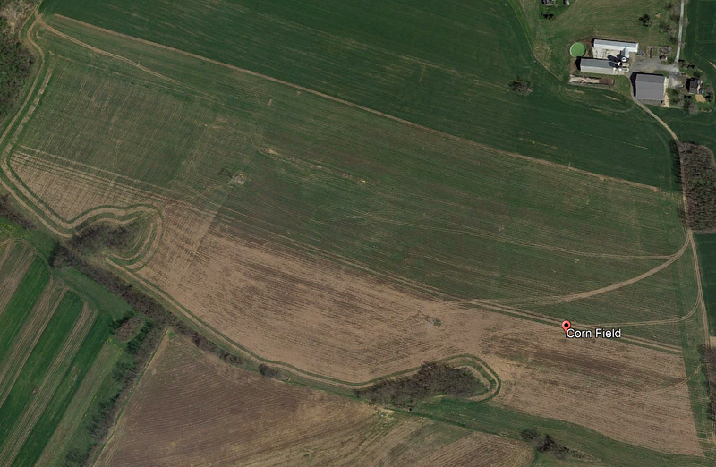
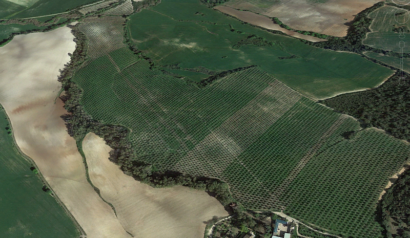
Using the different farming patterns in conjunction with equipment and buildings found on the land we can estimate a location based on region-specific crops.
Native Animal identification
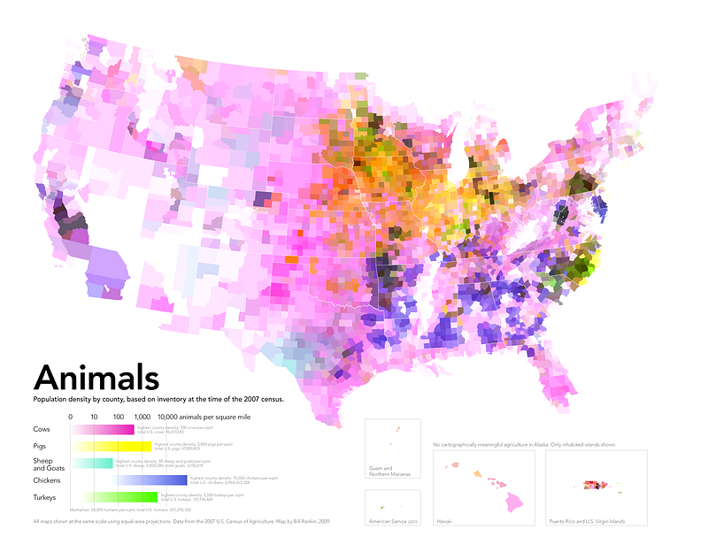
If our photo has a farm animal in the background, it might be possible to determine the location of a photo based on the farming industry. If we look at this map below of the U.S., we can see that livestock are farmed in patterns by region. For instance, based on this map, if our photo is of a pig farm we know to focus our search around the Iowa/Illinois area.
Birds are another great resource for nature geolocation as they often appear in all outdoor photos. Using a free app like Merlin Bird ID by Cornell allows us to identify a bird from an uploaded photo.
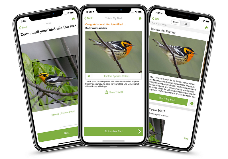
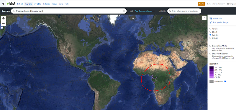
After we have identified a bird species like this dapper chestnut-Flanked Sparrowhawk below, we can go to a site like Ebird.org and view on a map where that species is native to.
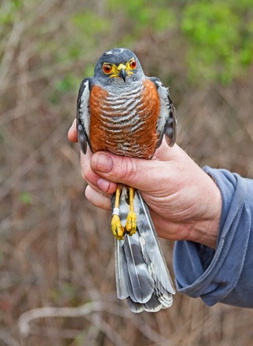
It quickly becomes apparent that this particular species of bird is only located in West Central Africa which narrows our scope immensely. From here we can combine this with native plants or trees in the photo and try to find an area that matches the picture.
Use Cases?
This all sounds pretty fancy but when would we ever need to use techniques like this? Well, if you want to practice I would definitely recommend Quiz Time. The daily verification puzzles often feature landscapes with plant life to investigate. A more noble cause would be Europol’s Trace an Object. Europol posts photos of instances of child exploitation (minus the child) and asks for assistance in locating where the photo was taken/what is in the photo. These pictures often have wooded areas that perhaps nature tracking could be used on.
If any of these techniques help in your investigations I would love to know! Please also let me know if you have any additional techniques to add.
Some great info for this blog was found at the Natural Navigator, check it out!